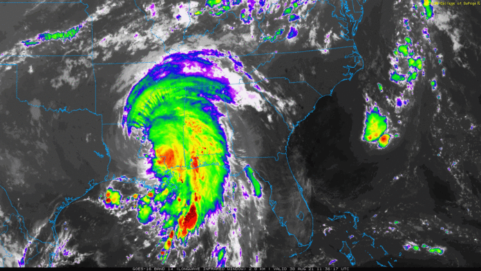
As quickly as Ida made landfall yesterday afternoon, it is already preparing to bring heavy rains to Tennessee state. The hurricane made landfall on Louisiana at a Category 4, and caused lots of damage, flooding and loss of power.
Tennessee will most likely be in the marginal risk for Tuesday as this system moves north into the area. Thunderstorms are likely with a few that could potentially be severe. The opportunity for stronger winds is still present as the storm still has great rotation.
Currently, FLASH FLOOD WATCHES are in effect until Tuesday evening for Middle Tennessee due to the forecasted heavy rainfall. Fortunately, rain fall amounts have decreased in the slightest, where majority of Middle Tennessee residents will see around 3-4″ of rain with Nashville and Northern portions of Tennessee still forecast to receive 4-5″. The National Weather Service is closely watching this storm as it continues to bring heavy rains along the south.
For more information on Tennessee rainfall from Ida, click on the link here.


